Business Details
47 Years
experience
Emergency
services
Trusted Land Surveying & Civil Engineering Services
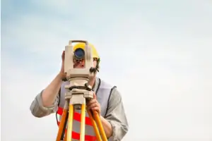
Since 1979, Kappa Surveying & Engineering has been a trusted provider of land surveying and civil engineering services throughout San Diego County and Southern California. As a second-generation, family-owned business, we combine decades of hands-on experience with technical expertise to deliver precise and reliable solutions for residential, commercial, and municipal projects. Our team of licensed professionals, including civil engineers and land surveyors, specializes in boundary surveys, topographic mapping, construction staking, and ALTA/ACSM standards compliance. With over 28 years of local experience, our lead surveyor has processed thousands of boundary-related maps for San Diego County municipalities, ensuring accuracy and regulatory adherence. Our engineering division leverages dual expertise in civil design and surveying to develop efficient, cost-effective site development solutions, from single-residence projects to large-scale infrastructure.We maintain active memberships in the California Land Surveyors Association and La Mesa Chamber of Commerce, reflecting our commitment to professional excellence and community engagement. Our staff's technical certifications, including Engineer in Training and Land Surveyor in Training credentials, ensure we meet evolving industry standards. We prioritize client collaboration, offering emergency response capabilities to prevent project delays while maintaining rigorous documentation practices for all survey records. Our 40+ years of combined experience positions us as a go-to resource for clients requiring precision land data and engineering solutions tailored to Southern California's unique geographic challenges.

Services
Boundary Survey
Elevation Certificate
Lot Consolidation
Monument Preservation
Setback Analysis
Topographic Survey
Details
- Year established: 1979
Highlights and features
- Family-owned since 1979 with 40+ years combined industry experience
- Dual-licensed civil engineers and land surveyors on staff
- Specialized knowledge of San Diego County municipal regulations
- Emergency survey response to prevent client project delays
- Active members of California Land Surveyors Association
Services
Boundary Survey
Our boundary surveys establish precise property lines using historical records and field measurements. Licensed surveyors document easements and encroachments to prevent legal disputes. Clients receive certified maps meeting California's strict documentation standards.
Topographic Survey
We create detailed elevation models showing natural and man-made features. This data supports site development plans and drainage analysis. Our surveys meet municipal requirements for construction permits in Southern California's diverse terrain.
Construction Staking
Our team marks exact building locations using survey-grade equipment. This ensures structures align with approved plans and zoning regulations. We provide ongoing verification throughout the construction process for residential and commercial projects.
Elevation Certificate
We document building elevations relative to flood zones for insurance requirements. Certified surveyors complete FEMA-compliant forms that determine flood risk and premium costs for San Diego County properties.
Monument Preservation
We locate and restore original property corner markers to maintain boundary integrity. This service prevents disputes during property transfers and ensures accurate future surveys across San Diego's evolving landscape.
People
Rick Turner
Licensed Land Surveyor
With 28 years of San Diego surveying experience, Rick has completed 2,600+ boundary and topographic surveys. He specializes in municipal map processing and maintains California Land Surveyors Association membership since 2002.
Bill Dick
Director of Engineering
Licensed civil engineer with 36+ years' experience, Bill oversees engineering projects combining surveying expertise. He develops solutions for projects ranging from single-family homes to 90-acre school sites across Southern California.
Kyle Thomas
Director of Surveys
EIT-certified Kyle manages survey operations since 2014. His dual expertise in engineering and surveying enables cost-effective design strategies. He provides emergency survey services to maintain client project timelines.
Jerry Jimenez
Associate Engineer
Jerry handles project assessment through AutoCAD design. With civil engineering and drafting certifications, he efficiently processes projects from site visits to final submittals using his technical expertise.
Questions
What surveying services do you offer?
We provide boundary surveys, topographic mapping, elevation certificates, monument preservation, and construction staking services for residential and commercial properties in San Diego County.
How can I request a project quote?
Use our website's contact form or call (619) 449-2600 during business hours to request a free consultation and customized project estimate.
Do you handle emergency surveying needs?
Yes, our team provides emergency response services to address urgent survey requirements and prevent project schedule disruptions across Southern California.
What engineering projects do you manage?
Our engineering division handles site development plans, drainage solutions, and infrastructure projects ranging from single-residence improvements to large-scale commercial developments.
How long have you served San Diego County?
We've provided surveying and engineering services since 1979, making us one of the region's most experienced family-owned firms with continuous local operations.