Business Details
18 Years
experience
Your Trusted Partner for Land Surveying and Civil Engineering Solutions
Morris Land Surveys was founded in 2008 with a commitment to delivering professional land surveying, civil engineering, and development consulting services. Our team of licensed professionals utilizes modern equipment and advanced methodologies to provide accurate and reliable solutions tailored to each project's unique requirements. With expertise in boundary surveys, construction staking, floodplain management, and land development, we serve clients across North Central Montana. Our philosophy emphasizes technical excellence, client collaboration, and fostering professional growth within our team.We maintain active involvement in industry associations and civic organizations, reflecting our dedication to both professional standards and community engagement. Our leadership includes certified professionals with extensive experience in public land survey systems and federal land certifications. Through strategic partnerships and a focus on innovation, we deliver comprehensive services that transform client visions into tangible results while upholding the highest ethical and technical standards.
Services
Land Surveying
Civil Engineering
GIS & Mapping
Development Consulting
Construction Inspection
Details
- Year established: 2008
Highlights and features
- We offer 15+ years of combined experience in land surveying and civil engineering
- Our team includes certified federal land surveyors and state-licensed professionals
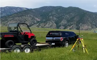
- We utilize modern equipment for accurate boundary determination and construction staking
- We provide comprehensive services from initial surveys to final development permits
- We maintain active leadership roles in state and national surveying associations
Services
Land Surveying
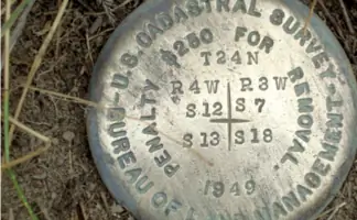
Our land surveying services encompass boundary determination, property mapping, and legal description preparation. We utilize advanced GPS and total station technology to ensure precise measurements for residential, commercial, and agricultural properties. Our team specializes in retracing original public land surveys and resolving boundary disputes through historical document research.
Civil Engineering
We provide civil engineering solutions including subdivision design, utility system planning, and roadway engineering. Our services cover water distribution, wastewater collection, and stormwater management systems. We specialize in creating cost-effective infrastructure designs that meet regulatory requirements while addressing site-specific challenges.
Development Consulting
Our development consulting includes zoning analysis, permit acquisition, and project management for land development projects. We assist clients with subdivision approvals, environmental assessments, and compliance with local regulations. Our team coordinates with government agencies to streamline the development process from concept to completion.
Construction Inspection
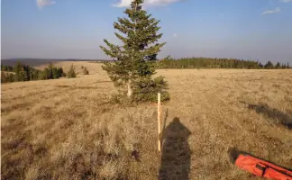
We offer construction inspection services to ensure project compliance with design specifications and regulatory standards. Our team provides field verification of grading, utilities, and structural elements. We maintain detailed documentation throughout the construction process to guarantee accurate implementation of engineering plans.
Floodplain Management
Our floodplain management services include FEMA mapping updates, flood risk assessments, and elevation certificate preparation. We assist property owners with flood zone determinations and mitigation strategies. Our certified floodplain manager ensures compliance with federal regulations while protecting client interests in flood-prone areas.
People
Matt Morris
Principal Surveyor
Licensed Professional Land Surveyor with 15+ years experience. Holds certifications in federal land surveying and serves as Montana Director for National Society of Professional Surveyors. Specializes in boundary surveys and public land system work.
Mark Larson
Project Manager
Dual-licensed Professional Land Surveyor and Engineer Intern. Specializes in land subdivisions and construction staking. Active in Montana Association of Registered Land Surveyors leadership since 2012.
Ryan Casne
Senior Engineer
Licensed Professional Engineer with expertise in water and wastewater systems. Owns Casne and Associates, Inc. and provides consulting services for complex infrastructure projects across Montana.
Sandor Hopkins
Floodplain Manager
Certified Floodplain Manager with experience in land development planning. Manages flood risk assessment projects and serves on local civic boards. Holds certification from American Institute of Certified Planners.
Cory Kelly
Survey Technician
Survey Technician pursuing professional licensure. Completed 32 credit hours in surveying coursework. Assists with field surveys and office drafting while preparing for LSI certification exams.
Questions
What services does Morris Land Surveys offer?
We provide land surveying, civil engineering, development consulting, construction inspection, and floodplain management services for residential, commercial, and infrastructure projects.
Which areas do you serve?
We primarily serve North Central Montana, including Choteau and surrounding communities, with projects extending across multiple counties in the region.
Are your surveyors licensed professionals?
Yes, our team includes licensed Professional Land Surveyors in multiple states and certified federal land surveyors with extensive industry experience.
How do you handle complex boundary disputes?
We conduct thorough historical document research and utilize advanced surveying technology to resolve boundary conflicts through precise measurements and legal documentation.
Can you assist with development permits?
Yes, our development consulting services include permit acquisition, zoning analysis, and regulatory compliance assistance for land development projects.
What makes your firm different from competitors?
Our combination of technical expertise, modern equipment, and leadership roles in professional associations ensures high-quality service with industry-leading standards.