Business Details
19 Years
experience
Expert GPS Machine Control & Surveying Services in Pennsylvania
Established in 2007, MESH Consulting has grown into a trusted leader in construction technology, delivering precision engineering solutions nationwide. Our team of professional engineers and experienced surveyors specializes in GPS machine control modeling, construction surveying, value engineering, and BIM coordination. We bridge the gap between site design and construction, ensuring seamless integration of digital models with field operations. With expertise in optimizing earthwork projects and resolving design conflicts, we serve clients across the Mid-Atlantic region and beyond. Our commitment to quality is reflected in our rigorous review processes, which identify and resolve issues before construction begins.By leveraging advanced technologies like GPS rovers, drones, and BIM software, we enhance project efficiency and accuracy. Our nationwide reach supports diverse projects, from residential subdivisions to airport runways, while maintaining local market expertise. We prioritize client collaboration, offering tailored solutions that reduce costs and prevent delays. With over 25 team members and thousands of completed projects, we combine technical excellence with practical construction knowledge. Our dedication to innovation and reliability has earned us long-term partnerships with industry leaders, ensuring clients achieve their project goals with confidence.
Services
GPS Machine Control Modeling
Construction Surveying
Value Engineering
BIM Modeling
3D Modeling
Grading Plans
Utility Design
Earthwork Balancing
Drone Surveys
Constructability Reviews
Details
- Year established: 2007
Highlights and features
- We offer nationwide GPS machine control modeling since 2007.
- Our team includes professional engineers and experienced surveyors.
- We provide comprehensive value engineering services for land development.
- Our services integrate with major GPS systems like Trimble, Topcon, and Leica.
- We ensure survey-quality accuracy and seamless project integration.
What people say
Thoroughly impressed with the level of detail
Great success on the parking lot
Complete confidence in runway extension
Well worth the investment
Seamless integration with GPS systems
Services
GPS Machine Control Modeling
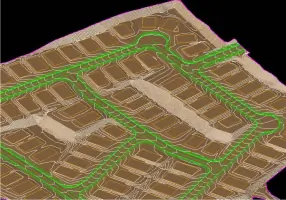
We create survey-grade 3D models for construction projects, ensuring compatibility with Trimble, Topcon, and Leica systems. Our models optimize earthmoving operations and prevent rework by resolving design conflicts pre-construction. Professional engineers review all data to guarantee accuracy and reliability.
Construction Surveying
Our survey crews use GPS rovers, robotic total stations, and drones to deliver precise stakeout, topographic surveys, and as-builts. Services cover roadways, utilities, and land development projects across the Mid-Atlantic region, supporting efficient project execution.
Value Engineering
We analyze grading plans and utility designs to improve constructability and reduce costs. Our team identifies earthwork balance issues and recommends modifications, ensuring projects meet design intent while minimizing delays and change orders.
BIM Modeling
We provide BIM coordination for civil projects, including initial modeling and as-built documentation. Our BIM solutions enhance project visualization, clash detection, and data management, supporting seamless integration from design to construction phases.
Drone Surveys
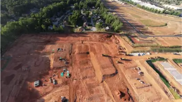
Our drone-based surveying captures high-resolution topographic data for large sites. This technology accelerates data collection, reduces field time, and provides accurate elevation models for grading and site planning.
People
Stephen Thomas
Managing Partner
Stephen Thomas is a licensed civil engineer with 20+ years of experience in land development and GPS surveying. He oversees engineering projects at MESH Consulting, leveraging expertise from both design and construction sectors to optimize project outcomes.
Stephen Narducci
Managing Partner
Stephen Narducci brings 35 years of construction industry experience, including leadership roles in heavy highway contracting. He specializes in GPS program strategy and implementation, offering clients strategic consulting to achieve project goals efficiently.
Kenneth Herwig
Survey Manager
Kenneth Herwig manages MESH's survey department, overseeing seven field crews and four office engineers. With a decade of GPS and dredging operations experience, he ensures precise data collection and field execution for complex land development projects.
Alexander Miller
Engineering Manager
Alexander Miller leads 3D machine control modeling at MESH, directing the creation of hundreds of models annually. With a civil engineering degree from Penn State and 12 years at MESH, he specializes in translating design data into actionable construction solutions.
Heidi Thomas
Controller
Heidi Thomas manages accounting, HR, and IT operations at MESH Consulting. A LEED-certified professional with a geo-environmental engineering background, she ensures financial and operational efficiency while supporting the company's technical infrastructure.
Questions
What services does MESH Consulting offer?
We specialize in GPS machine control modeling, construction surveying, value engineering, and BIM coordination for land development projects.
How does GPS machine control benefit construction projects?
It enhances grading accuracy, reduces rework, and improves equipment efficiency by providing real-time guidance for earthmoving operations.
Which areas do you serve?
We operate throughout the Mid-Atlantic region (PA, DE, NJ, MD, VA) and provide nationwide engineering support.
Can you handle large-scale infrastructure projects?
Yes, our team has extensive experience with airports, highways, and commercial developments exceeding $100M in value.
How do you ensure model accuracy?
All models undergo review by licensed engineers to resolve design conflicts and verify compatibility with field equipment.