
Business Details
Civil Engineering & Land Surveying Experts
Our firm brings together a dedicated team of 12 professionals, including three licensed engineers and a registered land surveyor, who collectively offer over 120 years of expertise in civil engineering and land surveying. With two in-house survey crews and a staff deeply rooted in Georgia, we combine local knowledge with technical proficiency to deliver precise, code-compliant projects. Our multistate licensing in Georgia, South Carolina, and Alabama enables us to serve diverse markets, from residential subdivisions to municipal infrastructure.Committed to client satisfaction, we prioritize clear communication and community engagement, ensuring every projectfrom concept to completion meets your vision and exceeds expectations. Our proven track record in site development, permitting, and construction coordination underscores our role as a trusted partner for engineers, developers, and municipalities.
Services
Site Development Plans
Land Surveying
Permitting Assistance
Construction Staking
Rezoning Support
Erosion Control Plans
FEMA Elevation Certificates
ALTA Surveys
GPS Control Networks
Municipal Infrastructure Design
Highlights and features
- 120+ years of combined civil engineering experience
- Licensed in Georgia, South Carolina, and Alabama
- Two in-house survey crews for rapid deployment
- Government permit specialists with CDBG/EIP expertise
- Georgia-native team with deep local knowledge
Services
Civil Site Development
We create comprehensive civil site development plans integrating engineering standards with local regulations. Our team ensures optimal land use through drainage solutions, utility coordination, and sustainable design. With 120+ years of combined experience, we deliver site layouts tailored to residential, commercial, and municipal projects across three Southeastern states.
Land Surveying
Our in-house survey crews conduct boundary determinations, topographic mapping, and ALTA/ACSM compliant surveys using GPS technology. We maintain registrations in two states to serve diverse projects including subdivisions, commercial developments, and government infrastructure requiring precise geospatial data.
Permitting Assistance
We specialize in securing environmental and construction permits including NPDES erosion control and CDBG/EIP grants. Our staff navigates state and federal requirements to obtain approvals efficiently, ensuring compliance while minimizing project delays for developers and municipalities.
Construction Staking
Our field teams translate engineering designs into physical markers using GPS-guided equipment. We provide precise layout for utilities, foundations, and infrastructure, maintaining dimensional accuracy throughout construction phases for residential, commercial, and public works projects.
Municipal Infrastructure
We design water and sewer extensions, storm drainage systems, and roadway improvements for cities and counties. Our engineers specialize in federally funded projects, meeting CDBG requirements while addressing community needs through sustainable infrastructure solutions.
Questions
What services do you offer?
We provide civil site development plans, land surveying, permitting assistance, construction staking, rezoning support, erosion control plans, FEMA elevation certificates, ALTA surveys, and municipal infrastructure design across the Southeast.
Which industries do you serve?
Our clients include residential developers, commercial property owners, municipalities, educational institutions, and government agencies requiring engineering and surveying solutions.
Are you licensed in multiple states?
Our engineers hold licenses in Georgia and South Carolina, while our surveyors are registered in Georgia and Alabama, allowing cross-state project execution.
What types of projects have you completed?
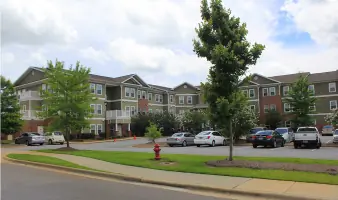
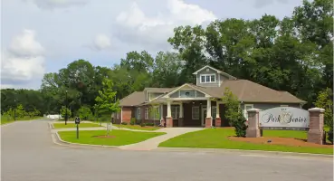
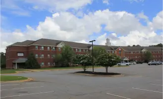
We've worked on multifamily housing, schools, municipal roads, water/sewer systems, commercial developments, landfills, and federally funded CDBG/EIP projects across the Southeast.
How do you ensure project accuracy?
With two in-house survey crews and GPS control networks, we maintain precise data collection and implementation throughout every project phase from initial surveys to final staking.