
Business Details
50+ Years
experience
Emergency
services
Your Trusted Partner for Construction Surveying Solutions
Wilson & Associates, P. C has been a leader in geomatics surveying and construction services since 1972, delivering precision and innovation across the Southeast. Our expertise spans transportation infrastructure, commercial development, and residential projects, utilizing cutting-edge technologies like LiDAR, BIM, and VDC. With a team of 9 professional surveyors, 7 civil engineers, and over 50 years of combined experience, we provide end-to-end solutions from land acquisition to final platting.Our commitment to technical excellence and client collaboration ensures projects are completed on time, within budget, and to the highest standards of accuracy. We serve private developers, municipalities, and contractors, offering rapid mobilization across Tennessee, North Carolina, and neighboring states. Our proven track record with DOT projects and advanced reality-capture methods positions us as a trusted partner for complex construction challenges.
Services
Transportation Construction
Data Modeling
Utility Coordination
Subsurface Utility Engineering
BIM Modeling
Virtual Design Construction
Dimensional Analysis
Commercial Construction
LiDAR Scanning
Surveying Services
Details
- Year established: 1972
Highlights and features
- We have over 50 years of experience in geomatics surveying and construction services.
- Our team includes 9 professional surveyors and 7 civil engineers with specialized expertise.
- We utilize advanced LiDAR, BIM, and VDC technologies for unmatched data accuracy.
- We support rapid mobilization across Tennessee, North Carolina, and 6 additional states.
- We offer end-to-end services from boundary surveys to final as-built documentation.
Services
Transportation Construction
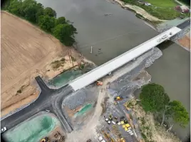
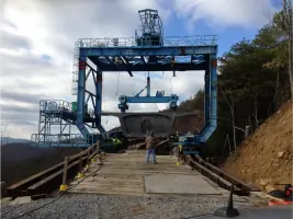
Our transportation construction services provide precise surveying and staking for infrastructure projects, ensuring accurate layouts and compliance with DOT standards. We support every phase from route surveying to final as-builts, utilizing LiDAR and 3D machine control to enhance efficiency. Our expertise reduces rework and accelerates project timelines for bridges, highways, and utility corridors.
BIM Modeling
BIM modeling creates detailed digital representations of construction projects, improving collaboration and decision-making throughout the lifecycle. We integrate real-world data to identify conflicts early, reduce costs, and streamline workflows for architects and contractors. Our models support facilities management and future renovations with precise documentation.
Utility Coordination
Utility coordination identifies and resolves subsurface and overhead utility conflicts before construction begins. Using SUE standards and LiDAR, we map existing systems to prevent delays and ensure compliance with municipal regulations. This service minimizes risks during excavation and supports seamless project execution for transportation and development projects.
LiDAR Scanning
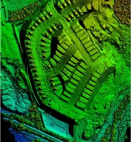
LiDAR scanning captures high-detail 3D data for complex environments, supporting planning and design with minimal disruption. We offer terrestrial, aerial, mobile, and bathymetric scanning to map structures, terrain, and underwater features with millimeter accuracy. This technology enhances quality control and reduces field time for construction projects.
Subsurface Utility Engineering
Subsurface Utility Engineering locates and maps underground utilities to mitigate risks and ensure project safety. Following ASCE quality levels, we verify depths and alignments to prevent strikes during excavation. Our SUE services support DOT compliance and reduce costly redesigns for infrastructure and development projects.
People
Joey C Wilson II
President & CEO
Joey Wilson leads Wilson & Associates, P. C with over 25 years of experience in civil engineering and land surveying. A licensed professional engineer and surveyor, he oversees operations and strategic growth while maintaining active involvement in major projects.
Jonathan Bailey
Vice President & COO
Jonathan Bailey manages construction survey services, bringing expertise in project coordination and field operations. With extensive experience in DOT projects, he ensures efficient execution of complex infrastructure developments across the Southeast.
Jon Slemp
Vice President & CPO
Jon Slemp directs survey design services, specializing in residential and commercial development. His focus on precision and client collaboration ensures seamless project delivery from initial planning to final platting documentation.
Justin Wilson
Executive Vice President & CCO
Justin Wilson leads sales and estimating, leveraging deep industry knowledge to connect clients with tailored surveying and construction solutions. His strategic approach strengthens partnerships and drives business growth.
Sean McGowan
General Manager
Sean McGowan oversees professional surveying services, ensuring high-quality data collection and compliance with industry standards. His technical expertise supports diverse projects including boundary surveys and topographic mapping.
Questions
What geographic areas do you serve?
We operate across Tennessee, North Carolina, and six additional Southeastern states with rapid mobilization capabilities.
What technologies do you use for surveying?
We utilize LiDAR scanning, BIM modeling, VDC, GPS, and 3D machine control for precise data collection and project execution.
Do you handle both public and private projects?
Yes, we support transportation infrastructure, residential developments, industrial facilities, and commercial construction for both sectors.
How do you ensure project accuracy?
Through advanced technologies, ASCE-certified SUE standards, and experienced professionals maintaining strict quality control measures.
Can you assist with emergency infrastructure projects?
Yes, we've completed urgent bridge replacements and time-sensitive surveys using rapid mobilization and LiDAR technology.